|
These are officially issued picture postal cards.
|
SERIES 1:
There are 122 cards in two sets, 1-72 issued in 1912, and 73-122 issued
in 1922.
The indicium on all is the same design as Scott 47, issued in 1910.
The cards show numbered (Ref # below) scenes in the Congo.
The earlier set was issued in two denominations, 5¢ (H&G 43) and 10¢ (H&G 44),
These cards were overprinted in 1921, 15¢ on 5¢ (H&G 54), 15¢ on 10¢ (H&G 55),
and 30¢ on 10¢ (H&G 56).
The later set was issued in 15¢ (H&G 63) and 30¢ (H&G 64 and 65).
The 30¢ value was issued in two colors, brown-red on cream (64) and violet-brown on cream (65)
According to the Higgins & Gage catalog, all views were issued for both denominations.
SERIES 2:
There are 50 cards in one set, issued in 1927.
The indicium on all is the same design as Scott 47, issued in 1910.
The cards show numbered (Ref # below) scenes in the Congo.
The set was issued in two denominations, 45¢ (H&G 69) and
1 Franc (H&G 70).
According to the Higgins & Gage catalog, all cards were issued for both denominations.
We show here the sixteen images known to have any rail connection.
(See also German East Africa
and Ruanda-Urundi.)
Abbreviations used below:
CFC = Chemin de Fer du Congo (Congo Railroad)
CFK = Chemin de Fer du Katanga (Katanga Railroad)
CFM = Chemin de Fer du Mayumbe (Mayumbe Railroad)
RRM = Mashonaland Railways
1/11/2005
I just found this great Belgian site (in French) -
http://www.congoposte.be,
which lists and describes all the postal issues of Belgian Congo
and German East Africa, including the postal cards:
http://www.congoposte.be/19121008.htm
http://www.congoposte.be/19171024.htm
http://www.congoposte.be/19220105.htm
These 1927 cards were all overprinted for use in
Ruanda-Urundi
(Belgian East Africa) -
http://www.congoposte.be/19270525.htm
(scroll down).
|
Here's another way to say all of that:
1912
H&G 43 - 5-cent yellow green on cream, 72 different views in black and white, #1-72
H&G 44 - 10-cent brown red on cream, 72 different views in black and white, #1-72
1921
H&G 54 - 15-cent surcharge on card 43
H&G 55 - 15-cent surcharge on card 44
H&G 56 - 30-cent surcharge on card 44
1922
H&G 63 - 15-cent blue green on cream, 50 different views in sepia, #73-122
H&G 64 - 30-cent brown red on cream, 50 different views in sepia, #73-122
H&G 65 - 30-cent violet brown on cream, 50 different views in sepia, #73-122
1927
H&G 69 - 45-cent gray green on buff, 50 different views in sepia, #1-50
H&G 70 - 1 Franc carmine on buff, 50 different views in sepia, #1-50
MILITARY OCCUPATION
German East Africa
1918
H&G 5 - 5-cent yellow green on buff, 50 different views, #1-50
H&G 6 - 10-cent dark red on buff, 50 different views, #1-50
1921
H&G 11 - 15-cent surcharge on card 5
H&G 12 - 15-cent surcharge on card 6
|
|
Many thanks to CJRRU member AJC (Albert) Borgstein of
South Africa for all his descriptive information about these
cards, as published originally in the journal of the South
African rail thematic group "Rail-Theme / Spoor Tema".
|
SERIES 1, set 1, Issued 1912, 72 cards numbered 1-72, H&G 43 (5¢) and 44 (10¢)
Overprinted in 1921 15¢ on 5¢ (H&G 54), 15¢ on 10¢ (H&G 55), and
30¢ on 10¢ (H&G 56).
|


|
Katanga, Elisabethville, laying tracks
Ref # 2
TG
AJCB:
Laying of railway track near Elisabethville.
(now Lubumbashi) Stamp: 5c.green. Construction work
on the CFK line from the Rhodesian border reached
Elisabethville on 27 September 1910.
|
| |


|
Katanga: On the Sakania to Elisabethville Line
Ref # 6
TG
AJCB:
Train on the Sakania - Elisabethville line. Stamp:
10c red. CFK locomotive of the 1-15 Class built in
1910/11 by Couillet, Haine St.Pierre and St.Leonard. It
was based on our (South African) 7 Class but was a woodburner
with Belpaire firebox instead. Note that this particular
engine's front bogie is derailed !
|
| |


|
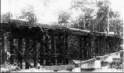
Temporary wooden railway-bridge across the Lukula River.
Ref # 10
AJCB:
Bridge across the Lukula River. Stamp: 10c red;
Temporary wooden railway bridge (30m); note the
tree trunks in the middle! Railway tracks not yet laid
on trunks although the righthand bridgehead has
rails on it. Lukula is halfway (81 km) on the Mayumbe
railway (CFM) which runs from Boma to Tshela.
|
| |


|
Port at Matadi with train station, tracks, locomotive.
Ref # 16
DL
AJCB:
Matadi harbour. Stamp: 5c green. This card
depicts the station (buildings in front) as well as the
locomotive shed (left) of Matadi. This is the harbour
from where the Congo Railway (CFC) starts to
Leopoldville (now Kinshasa), a distance of 400km.
Matadi is situated 160km inland on the Congo River.
|
| |


|
Mayumbe Station.
Ref # 25
TG and DL
AJCB:
Station in Mayumbe. Stamp: 5c green + 10c red.
The title of this card is incorrect as Mayumbe is
the name of the province and the name of the
local narrow-gauge railway (Mayumbe Railway). The station
shown is actually that of Boma, where this line starts
on its way to Tshele. There is a track running to the
right towards the jetty. See also two other photographs
of this station on a photocopy out of the
book "Le Rail au Congo Belge" (from which the photograph of the Lukula
bridge also originates). The station of Boma was a head-end type station
(see lower photo on the left) but one track continued on towards the
jetty. This track formed part of the first railway line in the Belgian
Congo, (see also text with postcard 27 where the jetty - with tracks -
can be seen). This track can also be seen on the righthand side of
the station in the upper photograph.
|
| |


|
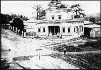
Boma: Post Office, with rail tracks
Ref # 27
DL
AJCB:
The Post Office of Boma. Stamp: 5c green.
On the lower left two tracks leading onto the jetty
can be distinguished. Boma had the first railway in
the Belgian Congo, a 2km narrow-gauge (610mm)
line from Boma-Rive (from jetty on the Congo River)
to Boma Plateau. It was opened on 4 March 1890.
|
| |


|
Leopoldville, the port, with tracks, steam engine in shed
Ref # 44
WS and DL
AJCB:
The port of Leopoldville (now Kinshasa).
Stamp: 5c green + 10c red. Warehouses and boats
on the shore of the Congo River. Also includes
railway trucks, tracks and even, on the right, a CFK
steam locomotive in a shed. The railway line from
Matadi reached Leopoldville in September 1898. By
1932 it was widened to Cape gauge and shortened
to 366km due to realignments.
|
| |


|
Lower Congo Railway at km. 5 (tracks only)
Ref # 49
TG and DL
AJCB:
Congo Railway line (CFC) at km 5. Stamp: 5c
green + 10c red. Four kilometers from Matadi the line
followed a tributary of the Congo River, namely the
M'Pozo River. This line on the section from Matadi to
Kenge (40km) is depicted here 1km further upstream,
and the river can be seen on the left of this card.
|
| |


|
Lower Congo Railway - Bridge over Pozo River
Ref # 58
DL
AJCB:
M'Pozo River bridge. Stamp: 5c green + 10c
red. This 30m railway bridge crosses this river at km
7.8 above rapids in the river (visibile on this card).
The same bridge appears also on the well-known
stamps used from 1909 to 1923.
|
| |


|
Panoramic view of Matadi with freight (and passenger?) cars in
background
Ref # 61
DL
AJCB:
Matadi harbour. Stamp: 5c green. This card
depicts the jetty of Matadi when it was in the
process of being widened. In front of the town are
also visible three passenger coaches and a large
number of goods trucks. A water tower for locomotives
can be seen on the right. An official visit is
taking place, note all the dignitaries dressed in white!
|
| |
SERIES 1, set 2, Issued 1922, 50 cards numbered 73-122, H&G 63 (15¢) and 64/65 (30¢) |


|
Departure of Capetown Train from Elisabethville Station
Ref # 74
TG and DL
AJCB:
Station of Elisabethville (now Lubumbashi) in
1918. Stamp: 15c grey + 30c red. Departure of the
train to Bulawayo and also the connection to Cape
Town. Coaches are those of the CFK (in front, combined
1st and 2nd Class carriages built by Franco
Belge) and Mashonaland Railways (RRM) in the rear.
|
| |


|
General view of installation at Union Mine, with tracks
Ref # 82
DL
AJCB:
The Union Miniere mine at Panda. Stamp: 15c
grey. Various railway tracks to and around mine
buildings are visible here. This is the coalmine at
Panda-Likasi on the CFK line from Bukama to
Elisabethville: it is situated about 17km south from
Kambove and 128km north of Elisabethville. The
Union Miniere company owned many mines in
Belgium and also operated in its colonies. Presently
this mining company is still in existence and also has
a branch in South Africa.
|
| |


|
Mines at Kambove
Ref # 85
Kambove mine. Stamp: 15c green. View of mines with tracks, ore cars.
Kambove (now Likasi) is situated on the CFK line.
|
| |


|
Loading mining wagon at Kambove
Ref # 86
TG
AJCB:
Kambove mine. Stamp: 30c red. Depicts loading of coal into
railway trucks by means of a wood-fired steam crane.
Kambove (now Likasi) is situated on the CFK line.
|
| |


|
TG
"A Bend on the Waterfall Railway near Matadi."
Ref # 104
AJCB:
The CFC line past Matadi. Stamp: 15c grey + 30c red.
This is a well-known spot in the mountains above Matadi.
Indeed, it is situated only 2.7km from the town where the line
hugs the sheer rockface through the famous curved cutting
with the Congo River below. The 0-4-0 tank locomotive is CFC
no.3, which was built by St. Leonard in 1890, hauling here a
short goods or construction train in the direction of the M'Pozo
halt (which is located just past the bridge, see card no.58). As
shown on this card this line is still 765mm narrow-gauge.
TG: I have never heard of the Waterfall Railway
Ed: An Internet search reveals that there is a waterfall on the Congo,
near the coast, between Matadi and Kinshasa (Leopoldville), but no specific
mention of a "Waterfall Railway".
AJCB: re: your problem about the so-called "Waterfall
Railway" - the text on the card is misleading in this context, I think what
the card-designer meant to say is "A curve in the railway line past the rapids
near Matadi". There is no waterfall near Matadi nor up the M'Pozo River further on.
The scene is 2.7km from Matadi near a famous cutting with the Congo River
below. This railway line runs from Matadi to Leopoldville. The railway
is called the 'Chemins de Fer du Congo' (CFC) and was built to bypass the
unnavigable (due to many rapids) Congo River. The CFC was later taken
over by Otraco but the line NEVER was known as the "Waterfall Railway"!
1/11/2005 - a viewer sent a link to
an Abebooks listing for a Belgian title that mentions "De spoorweg der Watervallen",
and a Google search in Dutch and English yielded further references, so
it seems clear that was its name. There is even a 1910 Belgian documentary film about it -
http://www.imdb.com/title/tt0276520/. Many other references to the name as well.
It appears the entire region is called "The Cataracts", so I think the
problem is with the translation - it should be "Cataracts", not "Waterfall".
Later -
I now have the book in my possession. There is a chapter called 'De spoorweg der Watervallen (1890-1898)' (p.227). It
has a map of the planned railroad from Matadi to Stanley-Pool (Leopoldville). It mentions the service it offers to the
african travellers who used to travel via the waterfalls. Elsewhere in the book there is a picture of the men who
'build' the 'spoorweg der watervallen'.
It is my belief that the falls are the 'Livingstone Falls'.
See:
http://www.britannica.com/eb/article-9048606/Livingstone-Falls
See:
http://education.yahoo.com/reference/encyclopedia/entry?id=11351
"...With railroads to bypass major falls (Matadi-Kinshasa;..."
|
| |
SERIES 2, Issued 1927, 50 cards numbered 1-50, H&G 69 (45¢) and 70 (1 Franc) |


|
Steam locomotives of the Katanga Railway
Ref # 5
Image courtesy of
Charles Stockmans
|
| |


|
Coal mine at Makala, tracks running into mine
Ref # 37
CJRRU member Don Lewis provided the following observations about this card:
I'm handicapped by not having the H&G. By studying the subject card and my
14 others, I soon deduced that the card is from a different set than the
two earlier sets, described on the website by Borgstein. Relative to the
two earlier sets, the #37 in question:
1. Paper is flimsier
2. Size is 138x88 mm vs. the earlier 140x90 mm for the first set but the
same as the second set.
3. View color is sepia as opposed to basically black & white.
4. The text on the front is entirely different.
5. The text and lines on the back are quite different.
6. The indicia is closer to the top and right edges.
7. The added stamp is Scott # 90, issued 1923-27. The need for the 15 ct
postage additional to the (already increased) 45 ct indicia strongly
suggests rising postal rates. Both these things suggest a later date.
8. The indicia color is dark green, less yellowish than the 5 cm indicia
of the first set and less bluish than the 15 cm indicia of the second
set.
9. Most importantly, the indicia engraving has significant differences
from both earlier sets, which between themselves have lesser
differences. The differences easiest to see are in the horizontal
background lines and in the curlicues at either end of the bottom
"Congo".
10. And, of course, the indicia is truly that, not a paste-on of any
type.
Many RR collectors, of course, would not include this card anyway,
because it shows mine tracks, not a "real" RR.
|
| |
|
These official postcards should not be confused with the ordinary
postcards issued by the publishing house Nels (Belgium) who also
issued large series of numbered postcards for the Belgian Congo
of which many depict railway scenes. Obviously the Nils cards
do not have the printed indicium on the card.
|

